Welcome to the official website of the Michigan Geological Survey (MGS). Our team of scientists works to better understand, preserve, and share Michigan geology. Using best available scientific methods, the survey conducts and facilitates geological investigations of Michigan’s natural resources and provides the public access to the state geological data repository.
Use the Programs and Resources menu on the left to browse all MGS content or use the Popular Topics menu on the right to find information more quickly.
To learn more about the importance of geologic mapping in Michigan, download our geologic mapping flyer or visit our About page.
Explore educational opportunities with the MGS! Whether you’re a student, educator, or geoscience enthusiast, MGS has something for you.
K-12 CoreKids Program: Access educational materials, classroom visits, and field trips tailored for K-12 students.
Outreach Team: Partner with us to bring geoscience to your events. We offer exhibits and speakers to enhance your event experience.
Career Development: Participate in career development activities, including large-scale exhibitions, local and regional events, and access digital resources available on our website.
Connect with the MGS Education and Outreach program to schedule your event.
MGS staff promoting earth science education at Capitol Day in Lansing.
What's New
The Latest MGS Newsletter Is Here
To kick off winter 2025, we released our latest newsletter, highlighting key activities from the past year, including updates on the Core Kids program, the MGRRE core repository, the Triage project, and more. Read the full newsletter and explore our latest updates on the MGS Newsletter page.
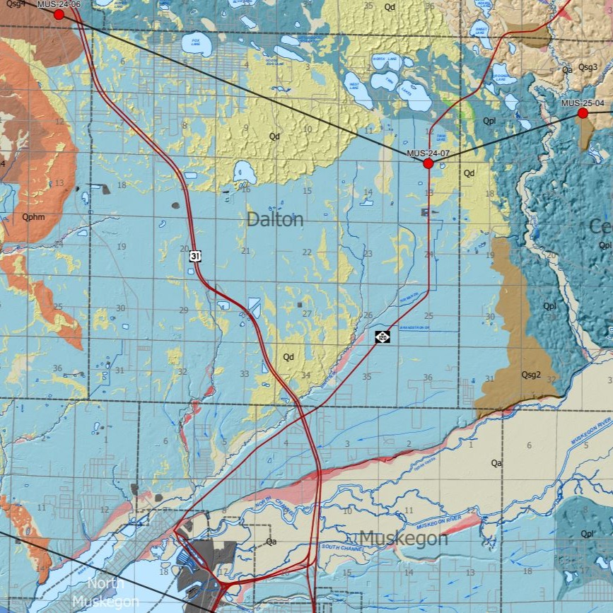
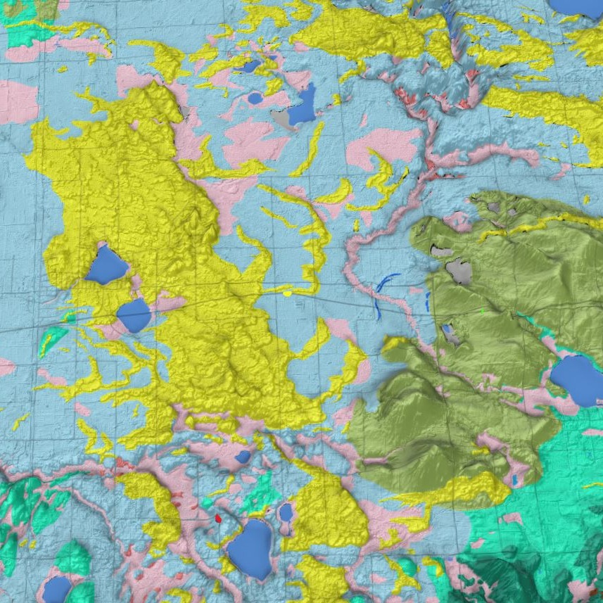
Surficial Geology Maps
In Fall 2025, we released a new surficial geology map for Muskegon County, an online web application for viewing the surficial geology of Allegan County in 2D and 3D, and the Michigan Borehole Inventory Dashboard. Links to the newly released maps and data are provided below.
Surficial Geology of Muskegon County
Recommended Citation:
Colgan, P.M., Erber, N.R., Ringle, G.B., Anderson, G.P., 2025, Surficial Geology of Muskegon County, Michigan, Michigan Geological Survey – Western Michigan University, Surficial Geologic Map Series SGM-25-01, Scale 1:62,500, September, 2025.
With this dashboard you can explore statistics about our cores and cuttings, information regarding other facilities that have Michigan specific cores, a calendar showing availability to visit our facilities, and other external resources by exploring our other pages.
We use cookies to ensure that we give you the best experience on our website. If you continue to use this site we will assume that you are happy with it.