Geologic maps show water, hazards, and resources—above and below the surface. Creating these maps is the central mission of the Michigan Geological Survey, without them Michigan lacks the tools for informed development, management, and protection of natural resources.
To learn more about the importance of geologic mapping in Michigan, download our geologic mapping flyer.
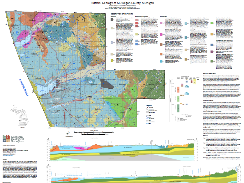
Map of the Surficial Geology of Muskegon County, Michigan.