Project Summary
In 2018, the Michigan Geological Survey (MGS) was awarded a grant from the State of Michigan’s Department of Environment, Great Lakes, and Energy (EGLE) to review locations that were identified as areas of concern for per- and poly-fluoroalkyl substances (PFAS) contamination by EGLE and the Michigan PFAS Action Response Team. As MGS produced hydrogeologic maps and cross-sections, it became apparent that a significant amount of the available geologic and hydrogeologic data in the Wellogic database, the state’s water well database, required correction and validation.
In 2019, the Wellogic Triage Team received additional grant funding through a budget revision to expand from validating specific locations, to entire counties while continuing to provide “Triage Packages” of hydrogeologic maps and cross-sections for identified PFAS contamination sites of interest.
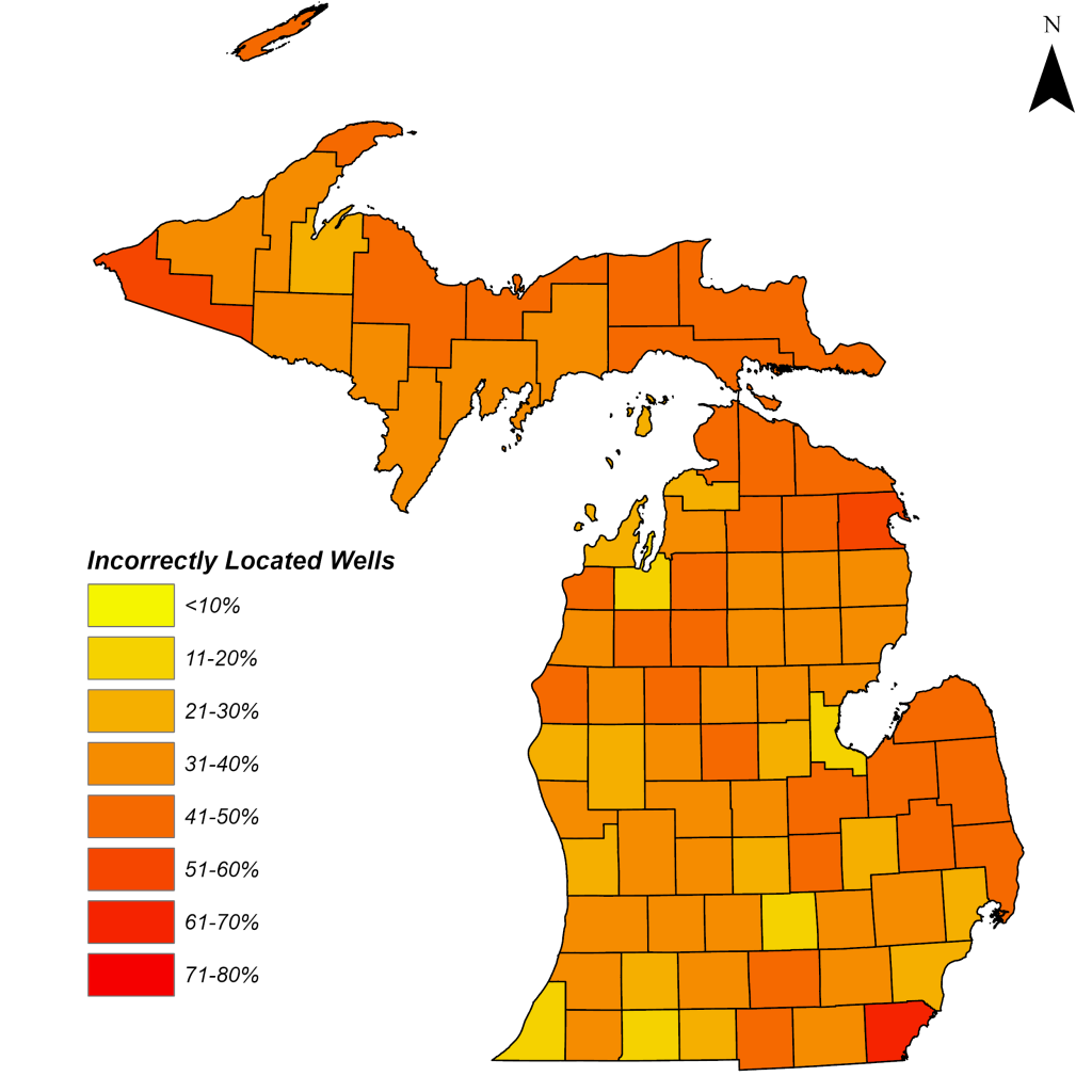
A final, additional grant was awarded to the Survey in October 2022, so the entirety of the state could be reviewed. Overall, the MGS Triage Team entered and reviewed 1.3M wells, validating the existing Wellogic locations and historical record scans available through EGLE of Michigan’s 83 counties and provided hydrogeologic maps and cross-sections for 73 PFAS contamination areas of concern.
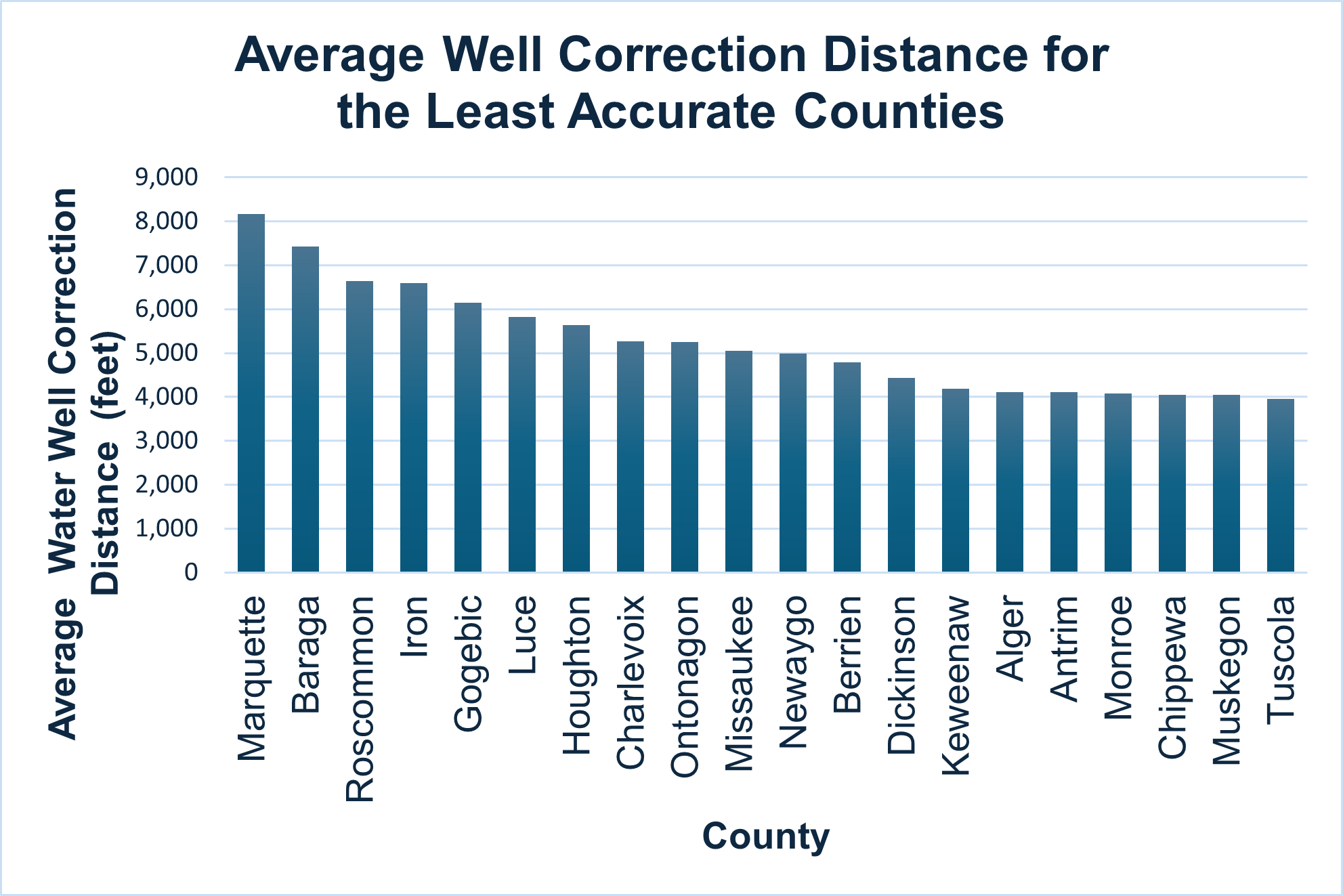
After 6 years, the MGS Triage Team officially entered and verified over 1.3 million water well logs in Michigan’s Wellogic Database. Verified reliable geologic and groundwater information for the entire state provides confidence in the Wellogic data that is used for decision making on new well placement, water use, source water protection, contaminant investigations, and more by homeowners, communities, and agencies across the state. The Wellogic database is the only comprehensive database with geologic and groundwater data in the state, and the Triage Team’s efforts have greatly improved the reliability and accessibility of the data having added significantly more data than was previously only available in analog format. Better data ultimately provides for better decisions about the protection of public health and the environment and what could be very significant cost and time savings to when the data is used for making these decisions. The investment in data accuracy, accessibility and usability like this Triage project has long term impacts that will benefit Michigan and its citizens long into the future.